Stakeholders
| Organization | Member Name |
|---|---|
| Agriculture Community Representative | Isaac Ellis |
| Boone County | Justin Aldred |
| Builder/Developer Representative | Susan Hart |
| Chamber of Commerce | **vacant** |
| City of Columbia | Betsy Peters |
| Columbia Public Schools | David Seamon |
| Department of Natural Resources | Mike Kruse |
| Large Scale Commercial Representative | Rob Wolverton |
| Property Owner | Jeanine Pagan |
| Property Owner | Scott Hamilton |
| Sierra Club | Dee Dokken |
| "Smart Growth" Perspective | Leanne Tippett Mosby |
| Soil & Water Conservation Board | Jeff DeShon |
| Stream Teams | Diane Oerly |
| University of Missouri | Dennis Elmore |
Key Stakeholder Documents
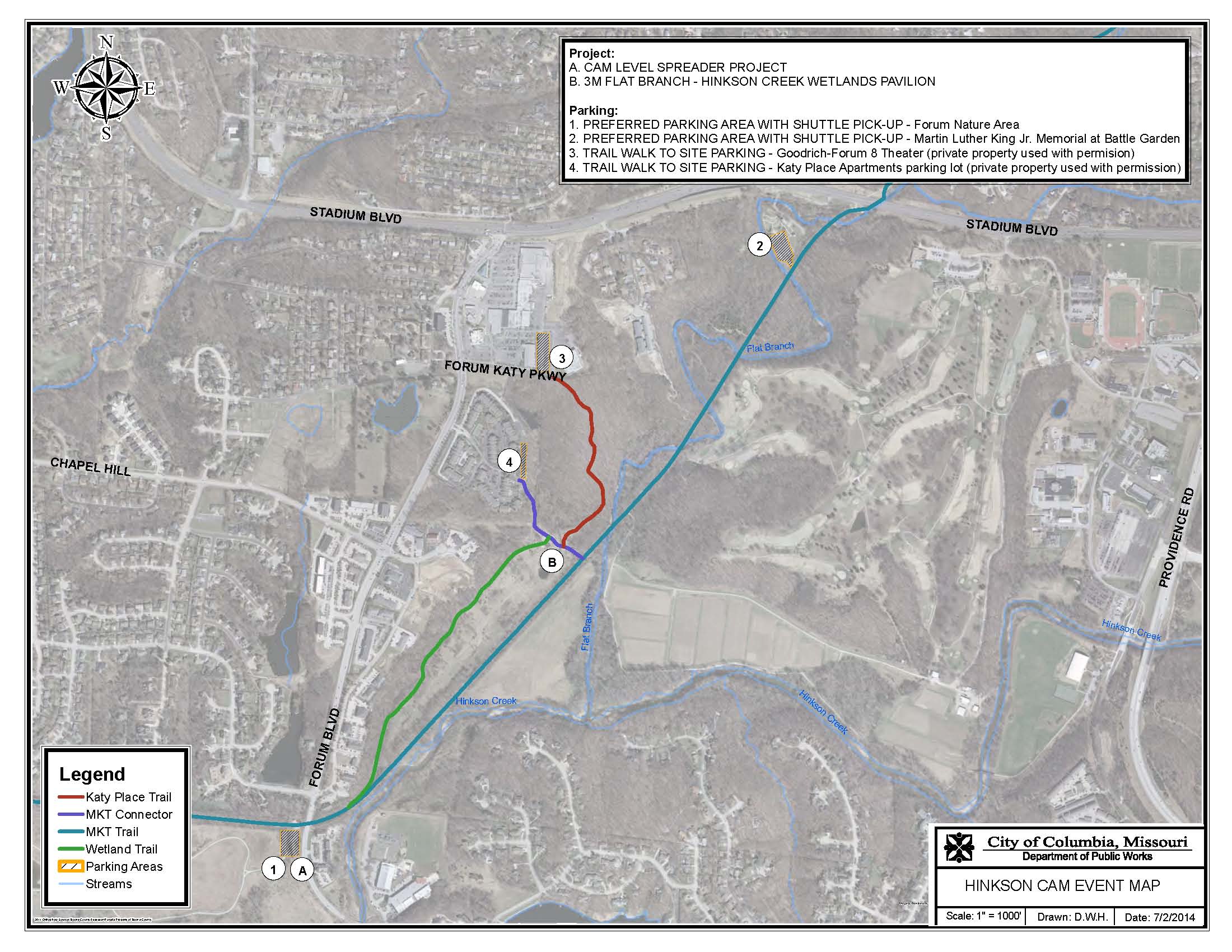
For CAM reports, videos, presentations, and other documents related to the Hinkson Creek CAM project as a whole, please see our Collective Info page.
Meetings
Stakeholder meetings are open to the public.
2025
Sep 30, 2025
Mar 5, 2025
2024
Sep 26, 2024
Mar 27, 2024
2023
2022
Dec 12, 2022
Jun 13, 2022
Mar 21, 2022
2021
Dec 13, 2021
Sep 27, 2021
2020
Jun 17, 2020
2019
Sep 24, 2019
Mar 7, 2019
2018
Sep 25, 2018
Jun 26, 2018
Mar 21, 2018
2017
Dec 11, 2017
Sep 27, 2017
Aug 29, 2017
2016
Dec 12, 2016
Aug 1, 2016
- Aug 1, 2016 Agenda
- Aug 1, 2016 Minutes
- Aug 1, 2016 Boone County Hinkson Projecy List
- Aug 1, 2016 Bore Pit Photos
- Aug 1, 2016 CAM Costs
- Aug 1, 2016 City CIP List
- Aug 1, 2016 Macroinvertebrate Data - May 2016
- Aug 1, 2016 Open Cut as Bore of Hinkson Creek
- Aug 1, 2016 Science Team Invertebrate Sampling Status
- Aug 1, 2016 Stream Buffer Ordinance