|
|
|
Do I Live in the Hinkshon Creek Watershed? Report a Spill/ Poor Erosion Control
|
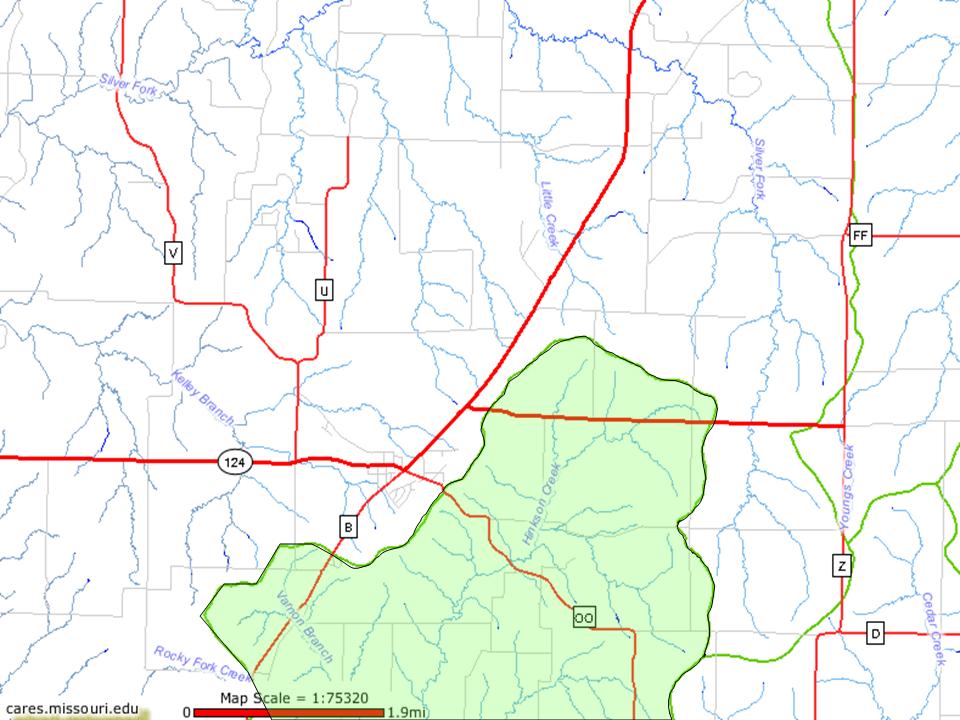
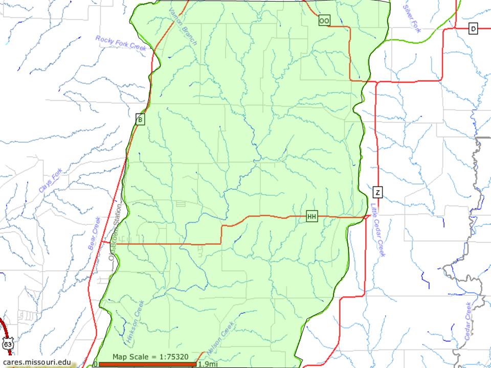
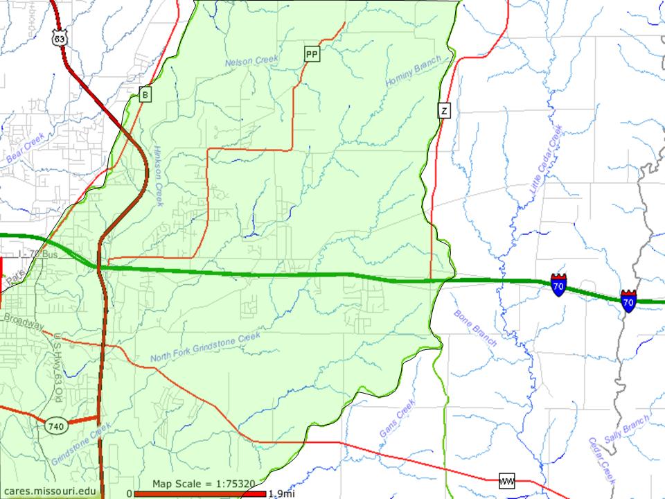
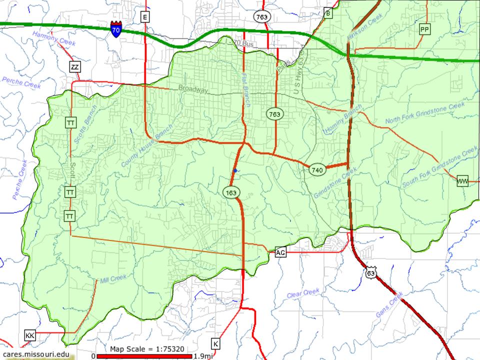
Hinkson WatershedThe Hinkson drains roughly 88.5 square miles of land, all in Boone County. Hinkson Creek itself is 26 miles long, originating east of Hallsville and traveling southwest to join Perche Creek in southwest Columbia. Several large tributaries spill into the Hinkson within the Columbia area. Grindstone Creek and Hominy Branch originate from the east, Flat Branch and County House Branch drain the interior of Columbia, and Meredith Branch and Mill Creek drain the western portion of Columbia. (The maps below will expand when touched by the cursor.)
Northern tip
More Watershed InformationWhat is a watershed - US Environmental Protection Agency
Other MapsFor an interactive mapping tool that allows you to view aerial photos, topographic maps, floodplains, and many more features, click here. (This will direct you to the Center for Applied Research and Environmental Systems website, select 'Columbia' from the list to get you started.) For a map of the sub watersheds of the Hinkson, click here. For a map of the hotspot area of concentration for our cost-share program, click here.
|